PVT Properties in the IGI Property Model
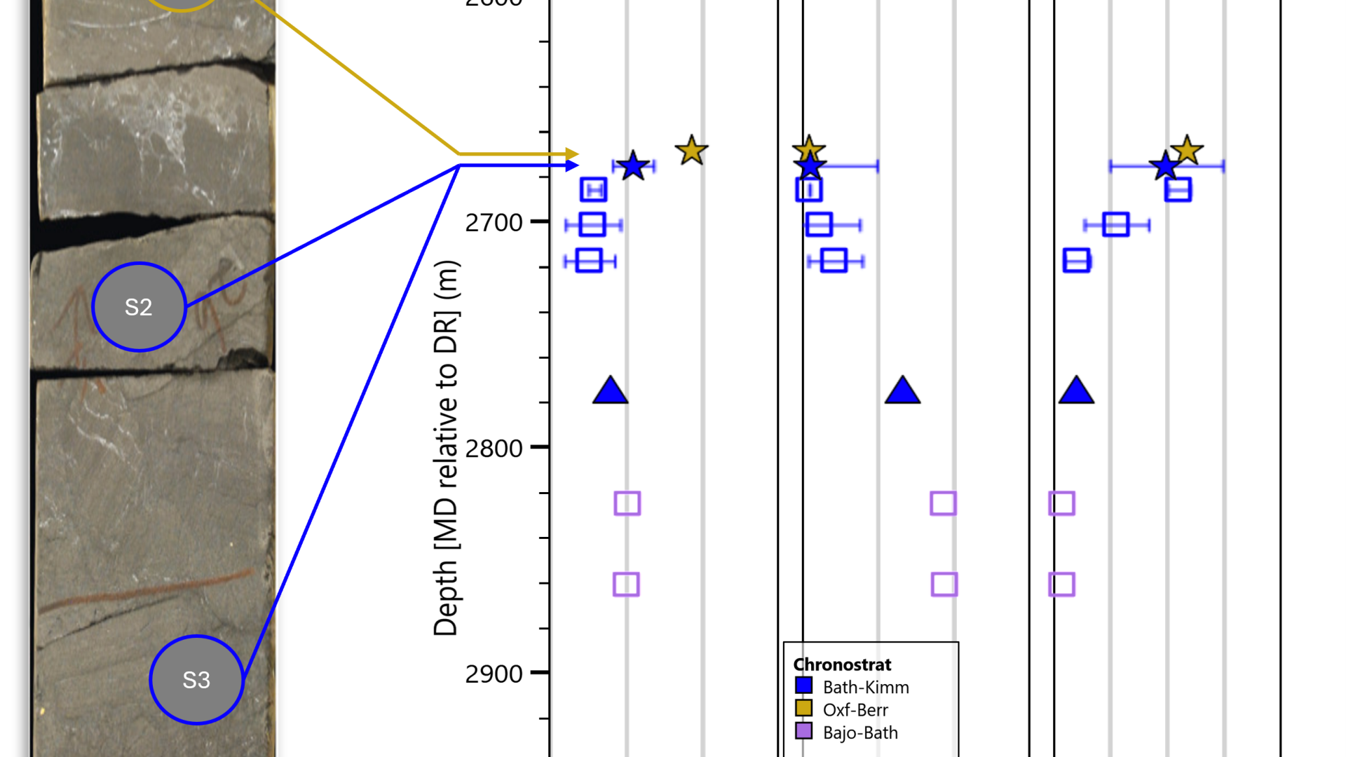
The IGI property model shipped with version 2. 3 of the software sees the introduction of a new PVT property model relevant to geochemistry.

Product Owner
Execution time: 0.3263 seconds, Peak memory usage: 12 MB
p:IGI+ makes importing, filtering, exploring and visualising sample data simple. Integrating advanced tools you can quickly provide consistent, reproducible interpretations.
The IGI property model shipped with version 2. 3 of the software sees the introduction of a new PVT property model relevant to geochemistry.
Product Owner
Dear users, we’re delighted to announce version 2. 3 of both p:IGI+ and Metis is now available.
The full release notes can be found here: Full-Release-Notes-2_3. pdf, here we summarise the highlights.
Product Owner
Unfortunately, as the sun set on the summer solstice on the beach at Westward Ho! we did not see a fabled green flash. However, there are several outcomes we can share with everyone!
First, we heard loud and clear, companies prefer fewer releases.
Product Owner
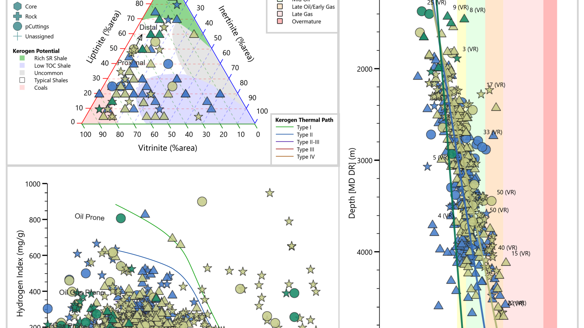
Explore data efficiently through predefined graphs with industry-standard overlays.
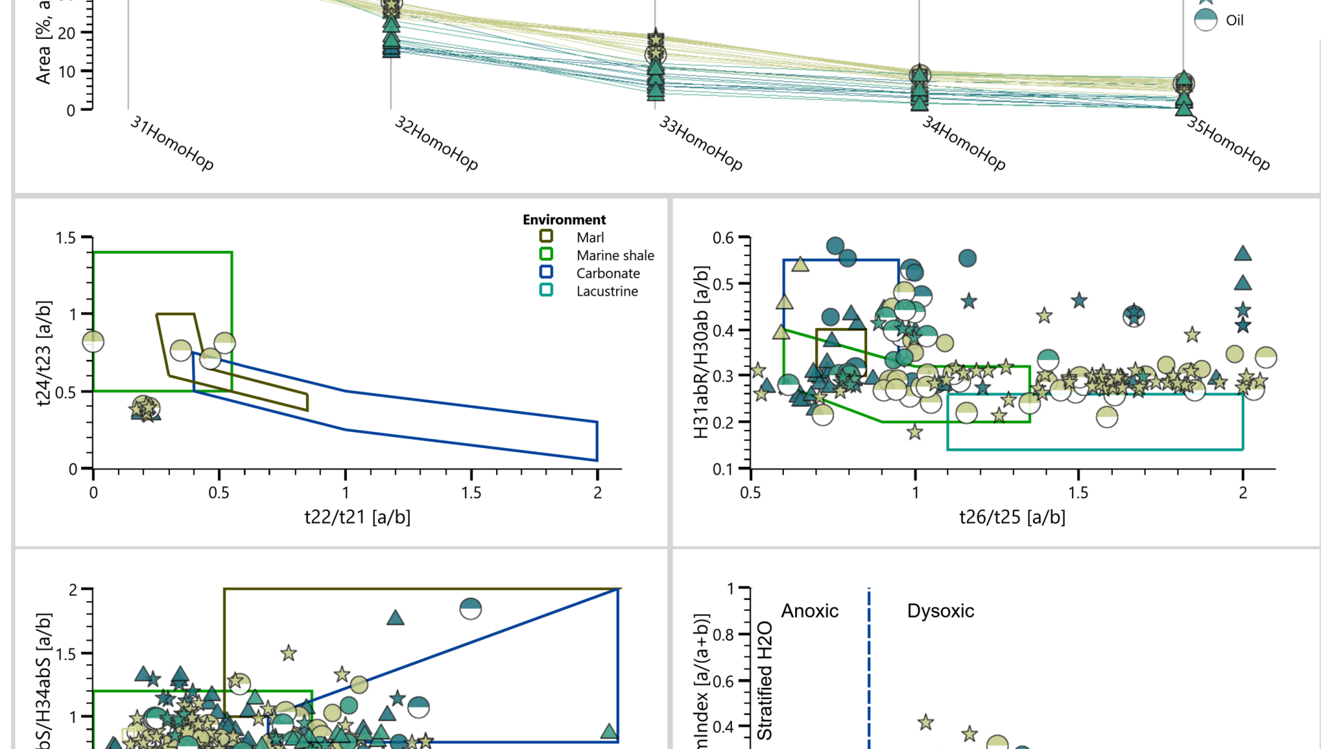
Follow a data-driven approach, using integrated data science methods, to identify relationships in data and discover trends and outliers.
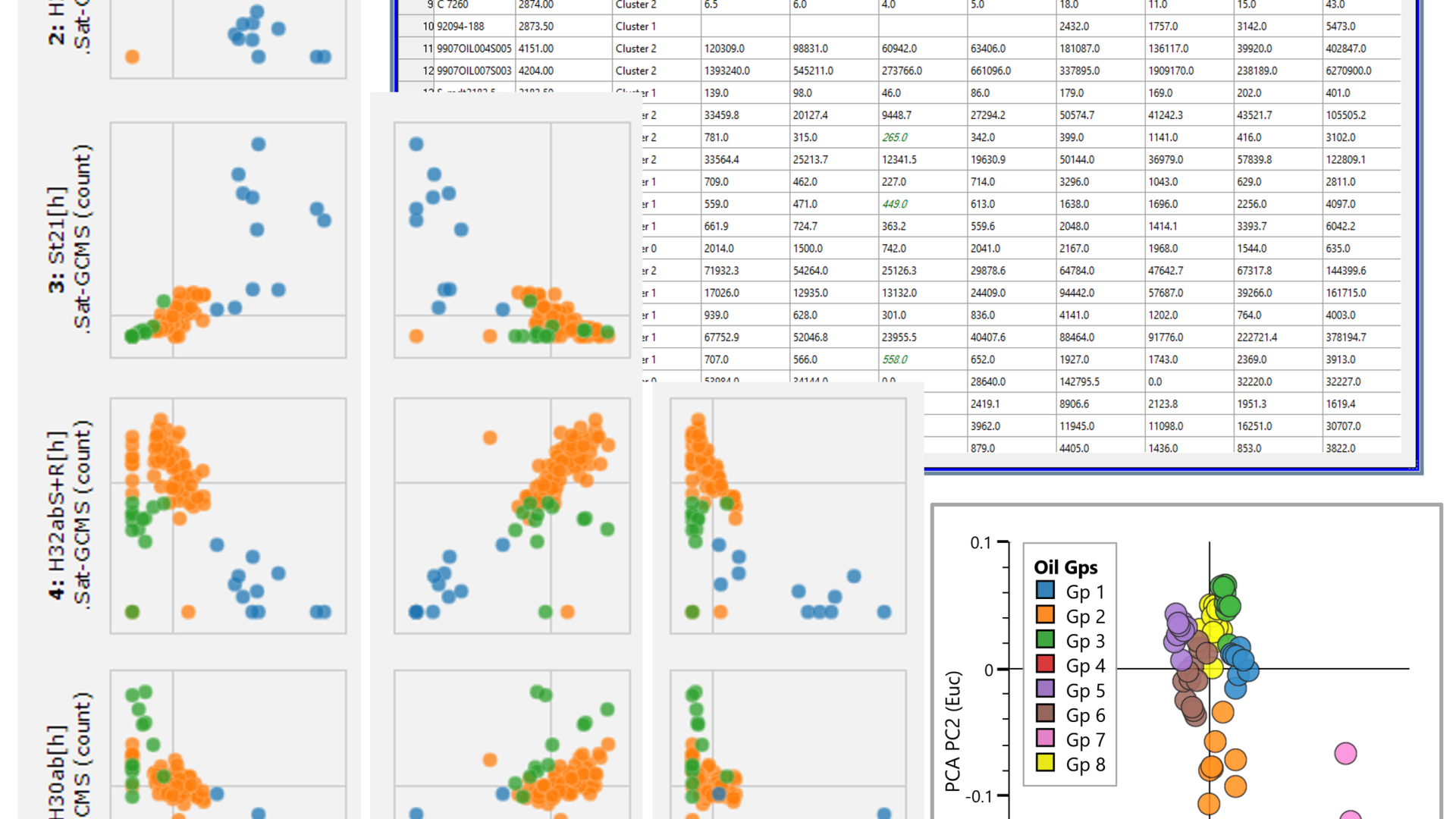
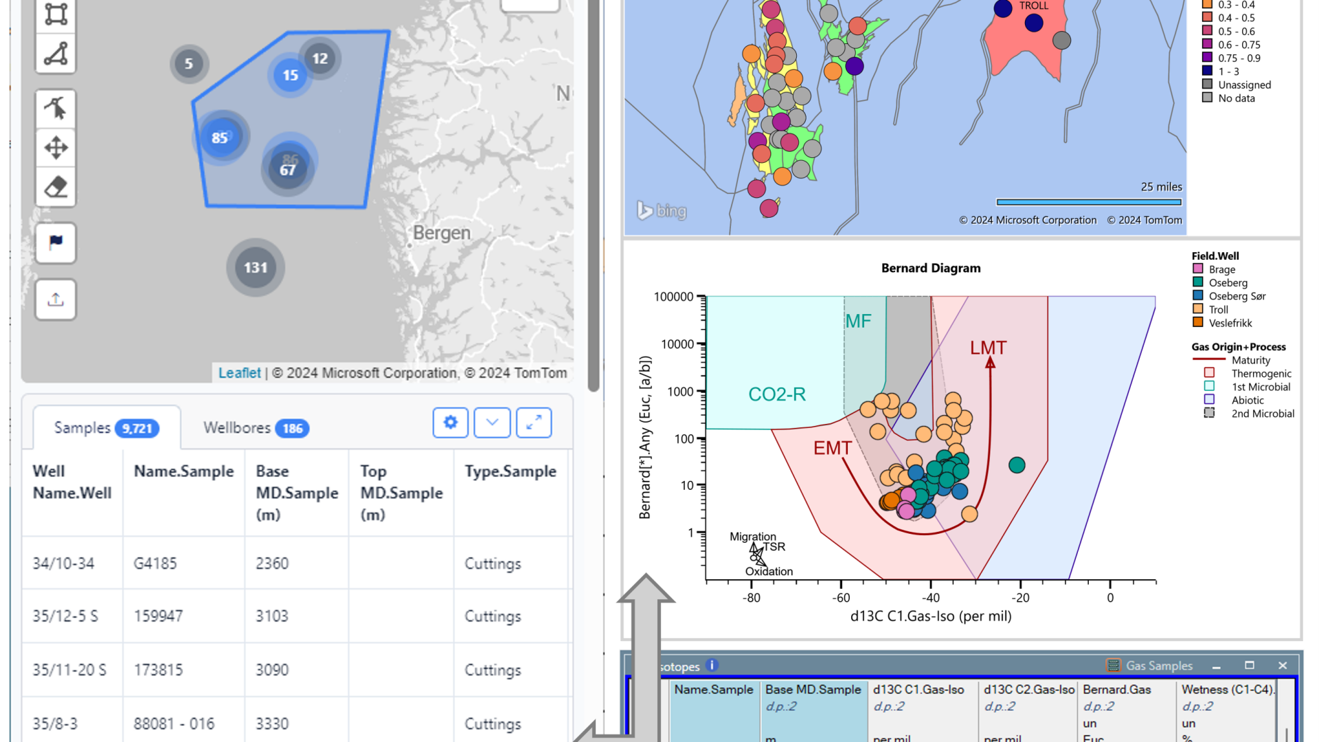
Integrated maps, statistical summaries and graphs enable you to contextualise your understanding of complex relationships across many variables.
Efficiently import, quality control, edit, gap-fill and collocate your data to get the most value from what you have measured.
Product Benefits
Increase productivity using a product customised to the petroleum geochemistry domain. Organise data effectively, especially when twinned with IGI’s ‘Metis’ centralised geochemical database.
High-resolution output aids the delivery of results to colleagues and management. p:IGI+ promotes consistency that drives fast comparisons between different datasets, plays or prospects.
Base decisions on predefined data views based on publications, taking advantage of explanations when twinned with IGI’s ‘ig.NET’ online geochemistry resource.
Graphs, palettes, maps and other data views assist users and companies to rank and de-risk at well, field, basin or regional scale.
“I’ve been using p:IGI+ to serve project purposes of both industry and academic environments, and I can admit it is super handy. Visualizing data, fast and rigorously considerably benefits my overall analysis and geo-interpretations. I can’t wait to see new features in the future!”